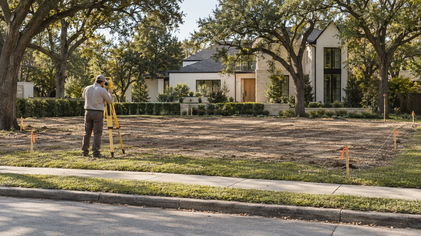
A survey locates your lot on the ground. A licensed surveyor finds the corners, measures the boundary, draws the building lines and easements from the recorded plat onto it, and shows where every existing house, garage, fence and driveway sits against those lines. An appraisal is an opinion of value — comparable sales, living area measured for pricing, condition — and it does not locate a single line on the lot.
So the two answer different questions. The appraisal tells a lender whether the property is worth the loan. The survey tells you, and us, where a house may go. You can design against a survey. You cannot design against an appraisal, however many square feet it quotes.
Two documents that answer two different questions
Most people buying a lot or a teardown in Greater Houston end up with both documents in the closing file, and it is easy to treat them as two versions of the same thing. They are not.
The appraisal is ordered by the lender. Its job is to support a number: what the property would sell for. To get there the appraiser measures the house's living area for pricing, compares it with recent sales nearby, and notes condition, age and features. The lot shows up as a size and perhaps a shape, usually taken from the public record rather than measured. Nothing in the appraisal says where the property line is, where the building line sits, or whether the neighbour's fence is 2 ft on your side of it.
The survey is a measurement. In Texas it is signed and sealed by a Registered Professional Land Surveyor, and it is the only document in the file that is built from fieldwork on the lot itself. The surveyor finds the corner monuments — usually iron rods driven into the ground, often buried under turf — measures between them, and ties what is on the ground to what is recorded.
There is a third document with a confusingly similar name: the appraisal district record, the county's tax listing. It is genuinely useful — its list of taxing units is the fastest way to tell which city or county permits your lot — but its land area is a tax figure, not a measurement, and it draws nothing.
What a survey actually shows
A residential boundary survey in Houston carries, at a minimum, the following. Each of them is something the appraisal does not have.
The boundary and the corners
The survey states the length and bearing of every side of the lot and shows the monument found, or set, at each corner. That gives you the lot's real width and depth to the tenth of a foot, rather than the rounded 50 × 100 from a listing. As the next section shows, a few inches of width or depth can move a lot from one row of an ordinance table to another.
The recorded building lines and easements
A plat is a map of the whole subdivision; a survey puts the plat's lines onto your lot as it actually sits on the ground. The building line along the street, any side building line, every utility or drainage easement and any reserve appear at their measured positions. We have written separately on why the plat outranks the ordinance in Houston; the survey is how that recorded map becomes a drawing you can put a house on.
Where everything already on the lot sits
The existing house, garage, pool, slab, driveway, fences and sheds are drawn and dimensioned to the lines. This is where surveys earn their fee. An appraisal will tell you the house has 2,400 sq ft of living area. The survey will tell you its back corner is 3.2 ft over a building line, or that the neighbour's driveway crosses your corner, or that the fence everyone treats as the boundary runs 2 ft inside it. A setback runs from the recorded line, not from the fence, so that last one changes what you can build.
A flood zone note — which is not an elevation
Many surveys carry a note of the flood zone the lot falls in, read from the federal flood map. Treat it as a pointer, not a measurement. The zone says how the map classifies the lot. It does not say how high the ground is, and on a flat Houston lot the height of the ground is what decides how high the house must sit.
Why the appraisal's numbers cannot be designed against
The appraisal contains numbers, and it is tempting to use them. Three reasons not to.
Its lot size is usually not measured. An appraiser reports site area, but typically from the public record or the plat, not from a boundary survey. If the record says 5,000 sq ft and the lot measures 4,960, the appraisal will not notice. An ordinance will.
Its square footage measures the wrong thing. The appraisal counts living area because that is what prices a house. Zoning counts footprint, because that is what covers the ground. A detached garage, a covered porch and a roofed outdoor room may add nothing to living area and a great deal to what lot coverage counts. The two numbers are not interchangeable in either direction.
It carries no lines at all. No setback, no easement, no building line, no dimension from the house to anything. Every question a design starts with — how wide can it be, how far back must it sit, where can the garage go — is a question about lines.
Where a few inches change the rules
This is the part people underestimate. Several ordinances in the region do not set one setback per district. They set a setback that depends on the lot's measured width or depth — so the survey does not just locate the rule, it selects it.
Bellaire. In the R-4 district the side setback is 8 ft if the lot is more than 90 ft wide, 6 ft between 70 and 90 ft, and 5 ft under 70 ft. In R-3 it is 8 ft over 90 ft and 6 ft at 90 ft or less. A lot sold as "70 ft" that surveys at 69.8 ft falls into the 5 ft row — a gain of 2 ft of width across the house. A lot sold as "90" that surveys at 90.3 ft falls into the 8 ft row and loses 4 ft.
Bellaire R-4 side setback, by the lot width the survey measures
West University Place. The front setback follows the depth of the building site: 20 ft if it is 110 ft deep or less, 25 ft if it is more than 110 and up to 125 ft, and 30 ft beyond that. A lot that measures 110.4 ft deep has a front setback 5 ft deeper than one that measures 110. The side setback is the greater of 10% of the width or 5 ft, and a separate narrow-site exception applies only below 55 ft wide and 6,000 sq ft — two more thresholds that only a measured width and area can settle.
Sugar Land. Corner lots must be 10 ft wider than the district minimum, so an R-1 corner lot needs 70 ft where an interior lot needs 60. Side yards must total 10% of the lot width, with no side under 5 ft, and a cul-de-sac lot takes 5 ft off the front setback.
City of Houston. Houston has no zoning, but Chapter 42 sets a 3,500 sq ft minimum for a single-family lot with wastewater service, and a 60% coverage limit applies only to lots reduced below that under Sec. 42-183(b). Which side of 3,500 sq ft a lot falls on is a surveyed figure, not a listing figure.
Bellaire R-4 Residential against Sugar Land R-1 Standard Single-Family
| Rule | Bellaire | Sugar Land |
|---|---|---|
| Minimum lot area | 5,000 sq ft | 6,600 sq ft |
| Minimum lot width | Not set by ordinance | 60 ft |
| Front setback | 25 ft | 25 ft |
| Side setback | 8 ft | 5 ft |
| Rear setback | 10 ft | 15 ft |
| Maximum lot coverage | 60% | 40% |
| Floor area ratio | Not set by ordinance | 0.71 |
| Height | 2.5 stories — 25 ft to the top plate of the second story and 35 ft 6 in at any ridge | 2.5 stories, not more than 35 ft from finished grade |
None of this shows up in an appraisal, because none of it affects what the property is worth today. All of it affects what can be built.
Why does height need a survey too?
Because in some cities height is not measured from the ground you stand on. Bellaire measures height from a reference elevation 3 ft above the average natural ground at the structure — or from the 500-year flood elevation plus 1 ft, where that is higher — and the ridge may never exceed 35 ft 6 in above the lowest top of foundation. Working out that datum needs ground elevations across the footprint. A boundary survey does not carry them. A topographic survey does, and an appraisal never will.
If you already have a survey's width and depth, the calculator below gives a rough buildable footprint. Its four contexts are generic approximations, not any named city's ordinance — the point is the order of magnitude, before anyone reads your plat.
Rough buildable floor area
—
A rough sanity check only. Real buildable area depends on your plat, recorded deed restrictions, HOA rules, floodplain, easements and tree requirements — none of which can be guessed from lot dimensions. Deed restrictions in particular are private agreements that override nothing here.
Which survey an architect actually needs
The survey in a closing file is usually a boundary survey with the improvements shown — enough for a title company, often not enough for design. Before we draw a house we usually ask for more:
- Spot elevations or contours across the lot and at the street, so we can set the finished floor, work out drainage and, in Bellaire, the height datum. Houston lots are flat enough that a few inches decide which way water runs.
- Trees, with trunk sizes and positions. West University Place lists tree protection among its permit requirements and the City of Houston lists tree and sidewalk requirements; a tree in the wrong place can move a garage.
- Visible utilities — meters, poles, cleanouts, manholes, the power drop — which decide where the service entrance and the driveway can go.
- Existing floor elevations, if a house is staying or being added to, so new floors meet old ones.
A good design set builds its site plan directly on this drawing; it is the first sheet in the drawings a custom home design produces, phase by phase. On our schedule it belongs in programming and site review, which runs 2 to 4 weeks at the start of a project, because everything drawn afterwards sits on it.
Why is the survey in my closing file sometimes years old?
Because in Texas a buyer can often close on an existing survey rather than a new one, with the seller signing an affidavit that nothing on the lot has changed since it was drawn. That is reasonable for a purchase. It means the survey you hold may predate the fence, the patio or the shed that now matters to the design. Check the date on it before you rely on it.
Where the survey is not the answer
We should be fair to the appraisal, and honest about the survey.
For interior work that changes nothing outside — a kitchen, a bath, a reconfigured floor plan inside the existing walls — the footprint is not moving, the lines do not matter, and we would not ask you to commission a new survey. The one in your file is usually enough for the permit. The survey matters when something is added to the ground: a new house, an addition, a pool, a garage, a larger slab.
And a survey has limits of its own. It is a snapshot on the day it was measured. It shows what is recorded on the plat and in the easements it was asked to find, but it will not tell you what the subdivision's deed restrictions say, which in Houston may set a deeper building line than anything on the plat. It shows the ground, not the rules — those still have to be read.
The appraisal, meanwhile, is doing its own job well. It is the best evidence in the file of what the land and house are worth, and on a teardown lot that matters when you are deciding what a new house can justify. It just has nothing to say about where that house can stand.
Common questions
Can I design a house from the survey I got at closing?
Sometimes, as a start. It will give the boundary, the recorded lines and the existing improvements. For new construction we usually need it updated with elevations, trees and utilities, and if it is more than a few years old, re-dated so it reflects what is on the lot now.
Does the appraisal tell me my lot size?
It reports one, but usually from the public record or the plat rather than from measurement. For anything that depends on exact width, depth or area — which, in Bellaire, West U, Sugar Land and the City of Houston, includes the setbacks themselves — use the survey.
Is the appraisal district's land area accurate enough to plan with?
No. It is a tax figure. Use the appraisal district record to confirm which taxing units — and so which city, if any — the lot belongs to, and use the survey for every dimension.
What does the surveyor actually mark on the ground?
The corners. The surveyor finds the existing monuments, usually iron rods, or sets new ones where they are missing, and often flags them. On request they can stake a building line or the corners of a proposed house before construction starts.
Do I need a new survey for an addition?
Usually yes. An addition moves the footprint toward a line, and the reviewer will want the new work dimensioned to the property line and the building line on a current drawing. Interior-only renovations generally do not need one.
For further reading on sizing up a site before design begins, see slab or pier and beam for a Houston custom home — the foundation decision is where the survey's elevations first turn into cost.